 After wrapping up a two-month long tree-ring expedition to Indonesia in March and April, 1996, I stopped off in Hawai'i for a week to obtain a few tree-ring samples in order to determine whether or not Hawaiian trees may be sensitive to climate variations.
In many ways, the trip didn't go as well as I would have liked. I was exhausted, jet-lagged, suffering from what would be come at least a six-month long bout of bronchitis and feeling abandoned by the people I was working for at Lamont-Doherty Earth Observatory.
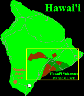
Nevertheless, I tried to get some sampling done on the "Big Island" -- Hawai'i. I obtained permission to stay and sample at Hawai'i Volcanoes National Park, and I did a bit more sampling at Manuka State Wayside (I think) near the southern tip of the Island.
My photography at this point wasn't that great. I screwed up the exposure on a number of shots, may have opened the camera with exposed film in it, and then lost the camera -- with more exposed film in it. It may have been stolen, but I didn't notice it missing until I went to the Pearl Harbor Memorial on the morning of my flight back to New Jersey, where I lived.
So, unfortunately, this is the best I could do. . .
NOTE ON THE MAP PROJECTION: The map above were produced using a Conformal Conic projection, which shows the surface of the Earth as if projected onto a cone. Conic projections are commonly used for mapping small portions of the Earth's surface. I give praise to Charles Culberson's excellent Versamap program which allows me to produce the base maps. They were shaded and annotated using Adobe Illustrator.